Severe Weather & Flooding for the Midwest

Top Stories
21 Jul 2025 2:05 AM
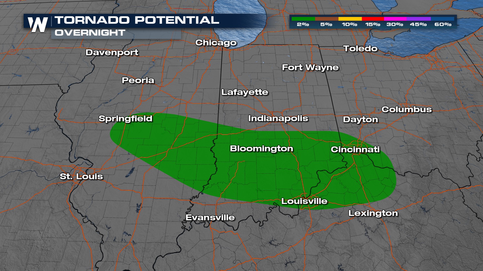
The Storm Prediction Center (SPC) has issued a marginal to slight risk for severe weather across portions of the Midwest. Strong winds and large hailstones will be possible with these storms. There will also be an isolated risk for tornadoes.

Forecast Timing
Thunderstorms stay focused near this stationary front through Monday.
Flooding Threat
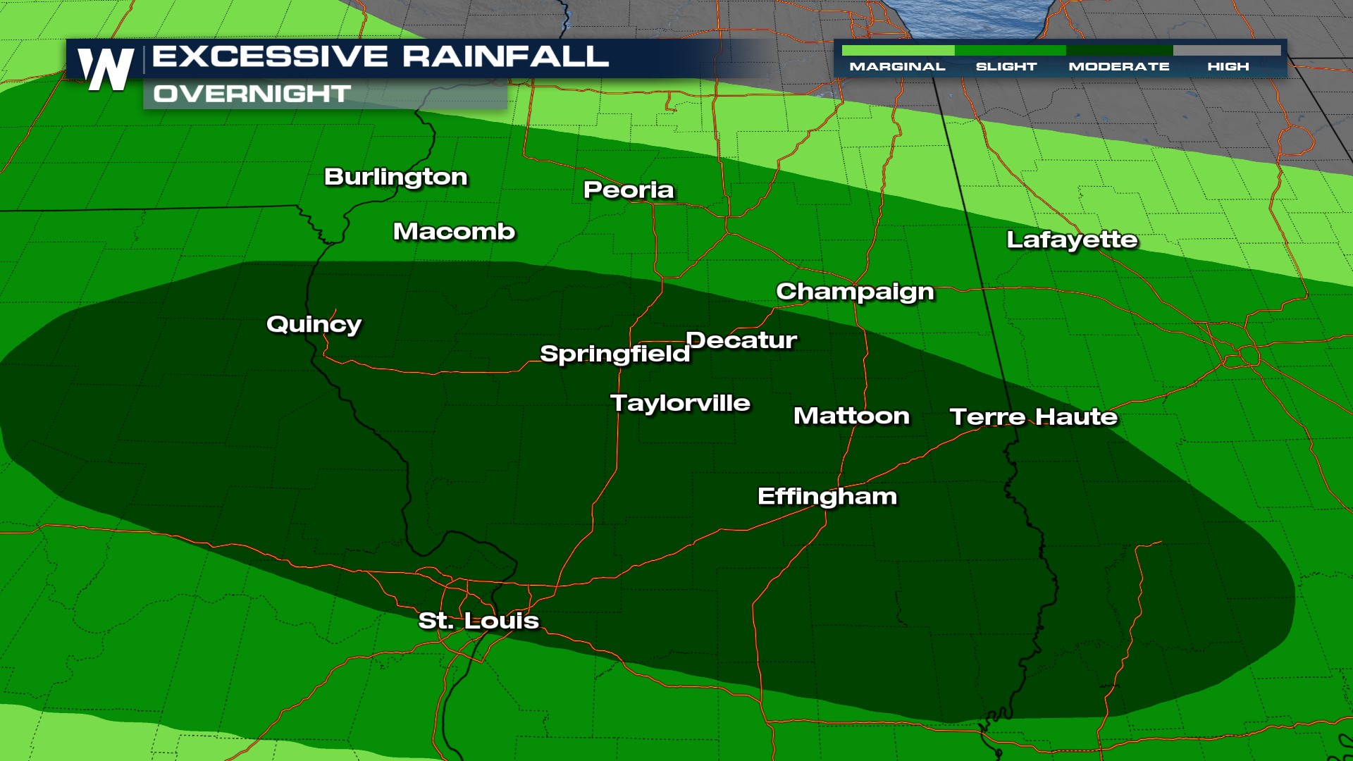
Flood Watches remain in effect into Monday. Thunderstorms could deliver 1-3 inches of rain accumulation.
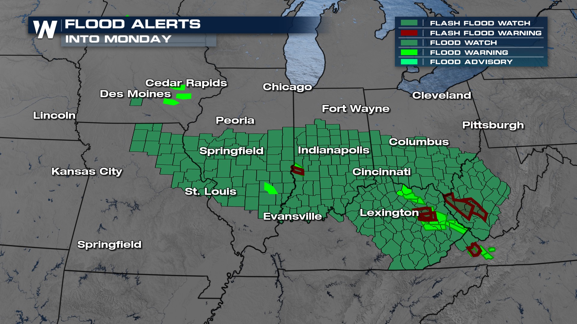
There is a moderate (level 3 out of 4) flooding threat for cities like Quincy, IL to Terra Haute, IN.
Stay with WeatherNation for the latest.
All Weather News
More

Severe Storms, Flash Flooding Overnight In Midwest
WHAT TO EXPECTIt was a very active day across
22 Jun 2026 1:50 AM


Summer Solstice Kicks Off Father's Day Sunday
Fathers across the country will have to share
21 Jun 2026 5:20 PM

Flood Risk Continues This Weekend for the Gulf Coast States
Numerous flash flood warnings were issued as
21 Jun 2026 1:15 PM

Dry T-Storms & Fire Danger in the West
A weak low-pressure system moving through the
20 Jun 2026 1:40 PM

Tornadoes Tear Through The Midwest, Isolated Severe Storms in the South
EARLIER THIS WEEKMONTROSE, IL - A dangerous t
20 Jun 2026 1:30 AM